
Hidden Landscapeslakelava flowsvolcanic
Lost Lake, Oregon: The Lake That Drains Into a Hole Every Summer
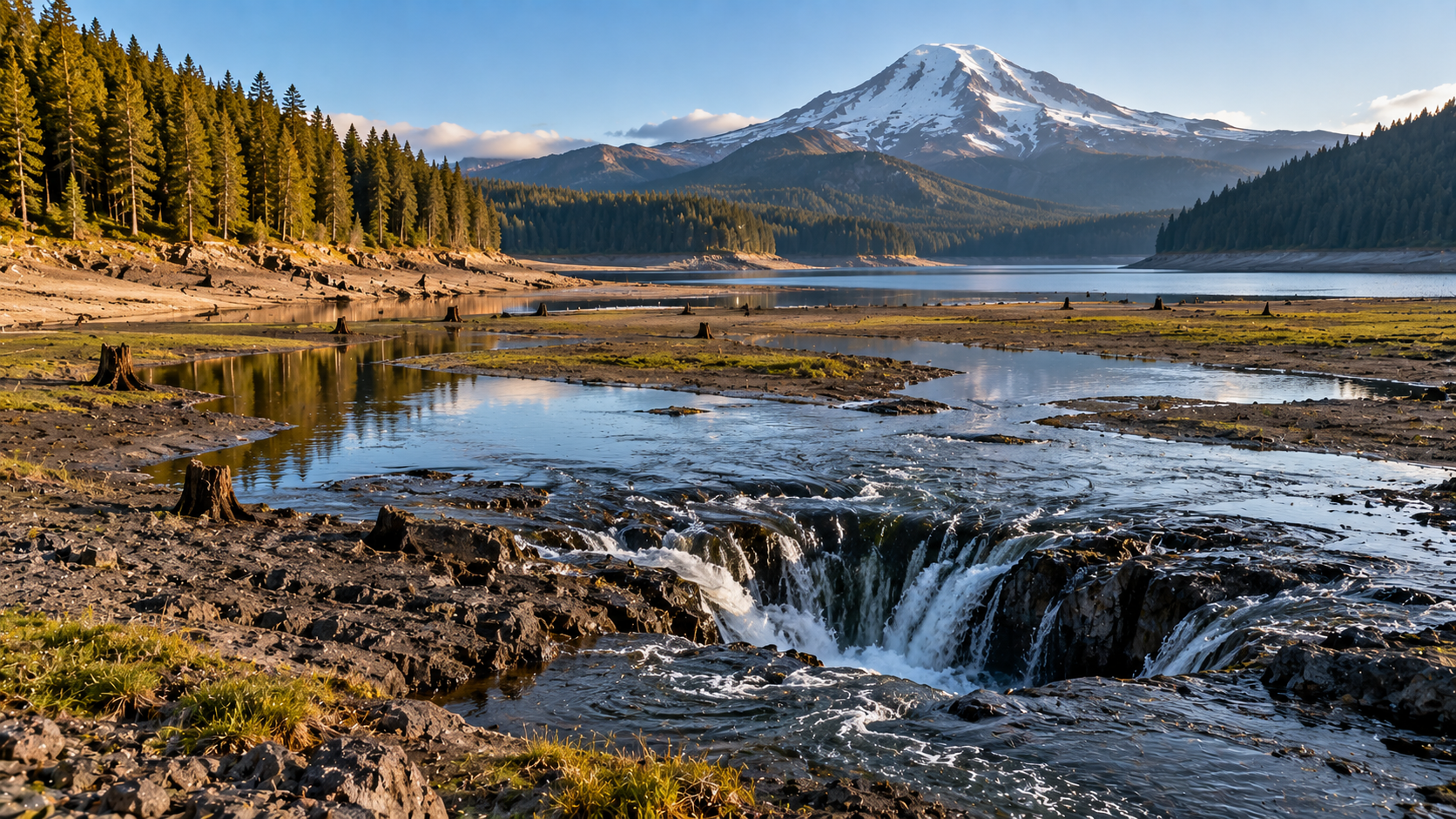
Every summer, Lost Lake on Oregon's Santiam Pass drains away through holes in its own lakebed, leaving a meadow. Every fall and winter, it fills again.
Every claim sourced
13 claims · 13 sources
0 disagreements logged
4 editorial corrections
Last checked Oct 2, 2026
The story
The numbered claim log below connects facts in this story to their sources.
eside one of the busiest highways across Oregon's Cascades, there's a lake that empties itself every year. Lost Lake sits just off Highway 20 near Santiam Pass, in the Willamette National Forest. In winter and spring it's a real lake, about 9 feet deep at its fullest, surrounded by pines and popular with anglers. But as summer arrives, the water level starts dropping. By late summer, in some years, the lake is mostly gone, replaced by a grassy meadow with a few pools. The water doesn't evaporate. It drains, down holes in the floor of the lake. The Forest Service describes two of them. One is about 7 to 8 feet across and about 6 feet deep, and when the water is flowing, you can hear it rushing into the ground. In 2015, a video of water swirling down the hole spread online and made the lake famous. The lake exists because of volcanoes. According to the Forest Service, it formed about 3,000 years ago, when lava from a nearby vent blocked an old river channel. The lava created a basin for water to collect, but it also left the ground below full of cracks and hollows. Several small streams flow into the lake, but the drain holes are its only known outlets. The cycle works like a sink with the drain left partly open. In fall and winter, rain and snowmelt pour into the lake faster than the holes can drain it, so it fills up. In summer, the streams slow down, the inflow drops below what the holes can carry away, and the lake empties. What's under the lake is still debated. The Forest Service has described the drain as a collapsed lava tube. A hydrologist who has studied it says it could be a lava tube or a sinkhole into a buried stream channel, and there's no way to know without a seismic survey. A Bend caver has argued that the lava flows in the area don't fit the pattern for lava tubes, and that the hole is more likely a collapse feature in the lava. In 2016, a new hole opened about 20 feet from the old one. Where the water ends up isn't certain either. It disappears into porous volcanic rock, and it likely recharges the underground aquifer that feeds springs in the area. Some believe it eventually reaches nearby Clear Lake, the source of the McKenzie River. Every fall the lake comes back, and every summer it goes down the drain again.
Last corrected: Oct 3, 2026.
Grew up near here?
Get the free Oregon guide: every Hidden Current place in the region, with what you can still see and how to get there.
State guides are coming soon. Email signup is not available yet.
Watch the short documentary
Lost Lake, Oregon: The Lake That Drains Into a Hole Every Summer
Claim log
| # | Claim | Sources | Status |
|---|---|---|---|
| 1 | Lost Lake is at 44.43262, -121.909506; it covers 50 acres; its elevation is 3,983 ft |
| Sourced |
| 2 | Lost Lake is in Linn County, Willamette National Forest, 18 mi SW of Mt. Jefferson, and drains in summer |
| Sourced |
| 3 | Lost Lake is off Highway 20 |
| Sourced |
| 4 | The lake is 9 ft deep, has two drain holes, and fills in late fall |
| Sourced |
| 5 | The lake formed 3,000 years ago; streams flow in; the holes are the only known outlets |
| Sourced |
| 6 | The hole is 7–8 ft across and about 6 ft deep; it may be a lava tube or a sinkhole; a footpath leads to it; rushing water can be heard |
| Sourced |
| 7 | The cycle works like a sink; the hole may lead to a buried channel |
| Sourced |
| 8 | A caver thinks the hole is a "pothole," not a lava tube; a new sinkhole opened in 2016; Oregon has 19+ Lost Lakes |
| Sourced |
| 9 | The drain is a collapsed lava tube; water seeps into an aquifer feeding springs |
| Sourced |
| 10 | Some believe the water reaches Clear Lake |
| Sourced |
| 11 | People have tried plugging the holes, which could flood the highway |
| Sourced |
| 12 | People have tried plugging the holes, which could flood the highway |
| Sourced |
| 13 | The Mount Hood Lost Lake doesn't drain |
| Sourced |
Disagreements logged
No approved disagreements are logged on this page yet.
Submit a disagreement
Disagree with a fact in this story? Submit a source-backed note for editorial review. It stays private until approved and does not automatically become a correction.
Sources
- Simple Wikipedia
- Wikipedia
- Charismatic Planet
- Live Science
- KLCC
- The Nugget Newspaper
- ABC30
- Fox News
- Backcountry Pilot forum
Corrections
| # | Correction | Sources |
|---|---|---|
| 1 | It is not settled that the lake drains into a lava tube: a hydrologist says the hole may be a lava tube or a sinkhole into a buried channel |
|
| 2 | A local caver argues the drain is likely a "pothole," not a lava tube |
|
| 3 | The draining Lost Lake is in Linn County near Santiam Pass, not near Mount Hood |
|
| 4 | The Lost Lake near Mount Hood does not drain |
|
More Hidden Landscapes places
- The Desert Hidden Between These Mountains
- Lake Nyos: The Lake That Released a Deadly Cloud in One Night
- Ruby Falls: The Waterfall Hidden Inside Lookout Mountain
- Thor's Well ("the drainpipe of the Pacific")
- Lost River, Indiana: The River That Disappears Underground
- Lake Kaindy: The Sunken Forest Drowned by an Earthquake