
Hidden Landscapessand dunesdesertmountain valley
The Desert Hidden Between These Mountains, Colorado
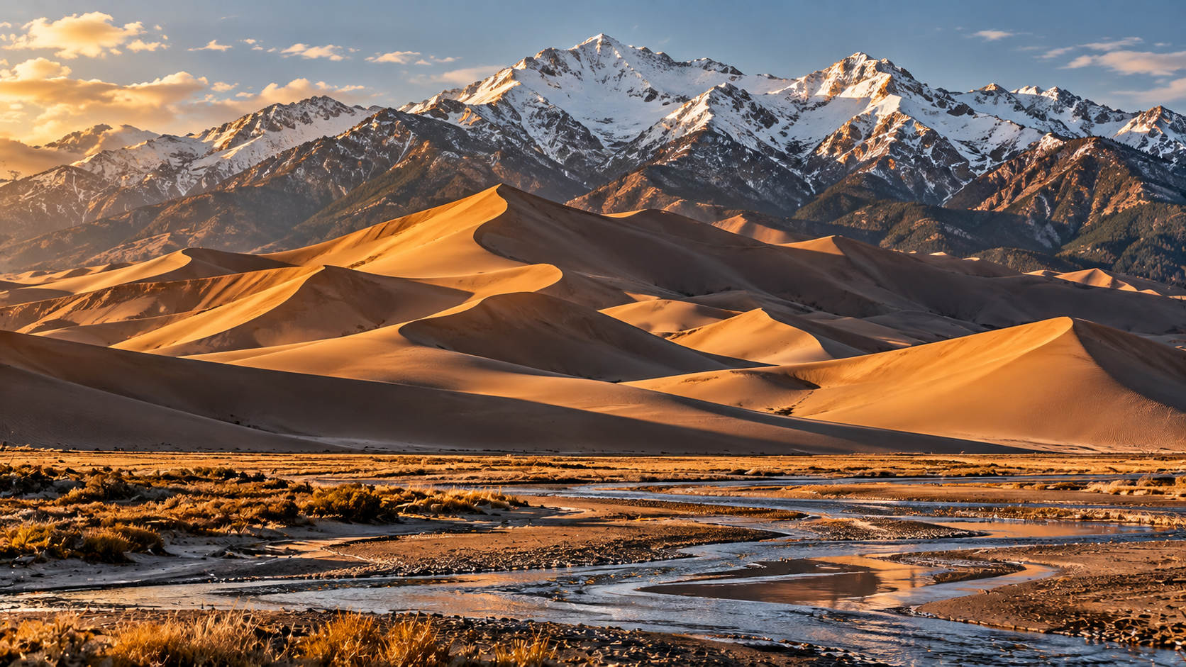
In a Colorado valley between two mountain ranges rise the tallest sand dunes in North America, built by wind, water and ancient lakes.
Every claim sourced
22 claims · 22 sources
0 disagreements logged
2 editorial corrections
Last checked Oct 4, 2026
The story
The numbered claim log below connects facts in this story to their sources.
At the foot of the Rocky Mountains, in southern Colorado, there's a field of sand dunes that shouldn't seem possible. Snow-capped peaks rise more than 13,000 feet behind it, and in front of them, piles of sand stand taller than the Washington Monument. These are the tallest sand dunes in North America. The dunefield covers about 30 square miles on the eastern edge of the San Luis Valley, a broad, high basin between the San Juan Mountains to the west and the Sangre de Cristo Mountains to the east. The valley floor itself sits at around 7,500 feet. The sand came from the mountains. Over hundreds of thousands of years, rivers and streams carried sediment down from both ranges, and ancient lakes filled the valley. When those lakes dried up, they left behind vast deposits of sand. The dunes began forming within the last 440,000 years or so, and much of their sand is volcanic rock fragments worn down from the San Juans. Then the wind went to work. The valley's prevailing winds blow from the southwest, carrying sand across the valley floor until it hits the wall of the Sangre de Cristo Mountains. But storm winds blow back the other way, down through the mountain passes. When wind pushes from one direction, dunes migrate and stay low. When it pushes from several directions, the sand piles up on itself and grows. That tug-of-war is what makes these dunes so tall. Water finishes the cycle. Medano Creek catches sand that blows toward the mountains and carries it back around to the edge of the dunefield, where the wind picks it up again. Every grain gets used over and over. The tallest dunes here trade the record back and forth. According to the National Park Service's official map, Star Dune stands about 736 feet and High Dune about 688 feet. The landscape is strange enough that planetary scientists study it as a stand-in for the surface of Mars. At least six species of insects live here and nowhere else on Earth, including the Great Sand Dunes tiger beetle. And because the park is so remote, it's an International Dark Sky Park. The dunes were protected as a national monument long before becoming a national park on September 13, 2004. Today, visitors can climb, sled and sandboard anywhere they like. The mountains still feed the sand, the wind still builds the dunes, and the creek still carries the sand back to start again.
Last corrected: Oct 3, 2026.
Grew up near here?
Get the free Colorado guide: every Hidden Current place in the region, with what you can still see and how to get there.
State guides are coming soon. Email signup is not available yet.
Watch the short documentary
The Desert Hidden Between These Mountains, Colorado
Claim log
| # | Claim | Sources | Status |
|---|---|---|---|
| 1 | The park is open 24/7 year-round with no timed entries or reservations |
| Sourced |
| 2 | The visitor center is open 9:00–4:30 daily in 2025, closed three holidays, at 11999 State Highway 150, Mosca, CO 81146 |
| Sourced |
| 3 | The visitor center elevation is 8,170 ft |
| Sourced |
| 4 | The entrance fee is $25 per vehicle for 7 days |
| Sourced |
| 5 | The entrance fee is $25 per vehicle for 7 days |
| Sourced |
| 6 | Fees are collected only when the station is staffed |
| Sourced |
| 7 | The sand surface can exceed 150°F; Medano Creek peaks late May–June |
| Sourced |
| 8 | Climbing Star Dune takes about 6 hours round trip; there are no marked trails |
| Sourced |
| 9 | The park is about 35 miles northeast of Alamosa |
| Sourced |
| 10 | The USGS park point is 37.776553, -105.628888 |
| Sourced |
| 11 | Star Dune is 736 ft and High Dune is 688 ft |
| Sourced |
| 12 | The sediment came from the San Juan and Sangre de Cristo Mountains |
| Sourced |
| 13 | The dunes began forming within the last 440,000 years |
| Sourced |
| 14 | The sand is up to 70% volcanic rock fragments; prevailing winds are southwesterly |
| Sourced |
| 15 | The dunes are tall because of wind from multiple directions |
| Sourced |
| 16 | Medano Creek recycles the sand |
| Sourced |
| 17 | Star Dune and Hidden Dune, both over 740 ft, trade the title of tallest |
| Sourced |
| 18 | The dunes are studied as a Mars analog |
| Sourced |
| 19 | Six insect species live here and nowhere else |
| Sourced |
| 20 | The park is an International Dark Sky Park |
| Sourced |
| 21 | The park became a national park on September 13, 2004 |
| Sourced |
| 22 | Mount Herard is 13,297 ft |
| Sourced |
Disagreements logged
No approved disagreements are logged on this page yet.
Submit a disagreement
Disagree with a fact in this story? Submit a source-backed note for editorial review. It stays private until approved and does not automatically become a correction.
Sources
- National Park Service
- True North
- NPS Fees & Passes
- Visit National Parks
- All About America
- Unusual Places
- TopoQuest
- NPS official park map
- Western National Parks Association
- Smithsonian
- NASA JPL
- NASA
- NPS FAQ
Corrections
| # | Correction | Sources |
|---|---|---|
| 1 | Star Dune is 736 ft on the official park map, not the widely repeated 750 ft |
|
| 2 | The dunes sit in a valley between two mountain ranges, the San Juan and Sangre de Cristo Mountains, not between two mountains |
|
Hidden Current within 100 miles
More Hidden Landscapes places
- Lake Nyos: The Lake That Released a Deadly Cloud in One Night
- Ruby Falls: The Waterfall Hidden Inside Lookout Mountain
- Thor's Well ("the drainpipe of the Pacific")
- Lost Lake, Oregon: The Lake That Drains Into a Hole Every Summer
- Lost River, Indiana: The River That Disappears Underground
- Lake Kaindy: The Sunken Forest Drowned by an Earthquake