
How It Really WorksDuga radarRussian WoodpeckerChernobyl
Duga: The Russian Woodpecker Near Chernobyl
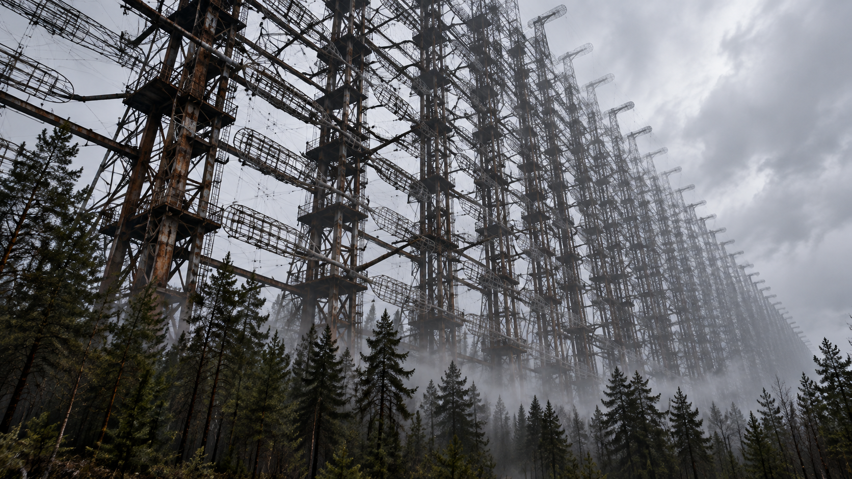
The Duga radar near Chernobyl, nicknamed the Russian Woodpecker, tapped across shortwave radio from 1976 to 1989. Its giant antenna still stands.
Every claim sourced
13 claims · 13 sources
0 disagreements logged
0 editorial corrections
Last checked Oct 8, 2026
The story
The numbered claim log below connects facts in this story to their sources.
In July 1976, radio listeners around the world began hearing a sharp, rapid tapping sound, about 10 beats a second, jumping across shortwave frequencies. Nobody announced where it came from. Listeners named it the Russian Woodpecker. The source was a secret Soviet over-the-horizon radar called Duga. It was part of the USSR’s early-warning network, built to bounce signals off the upper atmosphere and spot missile launches far beyond the horizon. Its receiving antenna, a steel wall about 700 meters long and 150 meters tall, was hidden in the forests of northern Ukraine. The transmitter sat about 50 km away. A second Duga system was built in the Soviet Far East, near Komsomolsk-on-Amur. The radar housed its crews in a closed military town known as Chernobyl-2, a few kilometers from the Chernobyl nuclear plant. It didn’t appear on Soviet maps. The Woodpecker’s random frequency jumps disrupted shortwave broadcasts, amateur radio, and aviation and ocean communications. Thousands of complaints came in from many countries. In April 1986, the Chernobyl reactor exploded nearby, and the area around it became the Exclusion Zone. The Woodpecker kept tapping until December 1989, when the signals stopped for good. The giant array still stands. Ukraine has named it an Immovable Monument of National Significance. Before 2022 it was one of the most photographed stops on Exclusion Zone tours. Since the war began, it has been off limits to tourists.
Last corrected: no editorial corrections on this page yet.
Grew up near here?
Get the free state guide: every Hidden Current place in the region, with what you can still see and how to get there.
State guides are coming soon. Email signup is not available yet.
Watch the short documentary
Duga: The Russian Woodpecker Near Chernobyl
Claim log
| # | Claim | Sources | Status |
|---|---|---|---|
| 1 | The Duga receiver is at 51°18′19.06″N, 30°03′57.35″E, about 12 km west-north-west of Chernobyl. |
| Sourced |
| 2 | The transmitter is at 51°38′15.98″N, 30°42′10.41″E, about 50 km northeast of Chernobyl. |
| Sourced |
| 3 | Duga operated from July 1976 to December 1989. |
| Sourced |
| 4 | The antenna is about 700 m long and 150 m high. |
| Sourced |
| 5 | Duga was an over-the-horizon radar in the Soviet early-warning network meant to detect missile launches. |
| Sourced |
| 6 | Shortwave listeners nicknamed it the "Russian Woodpecker" because its signal sounded like tapping at about 10 Hz. |
| Sourced |
| 7 | Its random frequency hops disrupted shortwave broadcasts, amateur radio, oceanic, commercial and aviation communications. |
| Sourced |
| 8 | The interference led to thousands of complaints from many countries. |
| Sourced |
| 9 | Duga-2 is near Komsomolsk-on-Amur in Khabarovsk Krai. |
| Sourced |
| 10 | Chernobyl-2 was a closed town housing the system's receivers. |
| Sourced |
| 11 | Chernobyl-2 did not appear on maps during the Soviet era. |
| Sourced |
| 12 | The Duga-1 array is an Immovable Monument of National Significance of Ukraine. |
| Sourced |
| 13 | Due to the war in Ukraine, the site has been inaccessible to regular tourists since March 2022. |
| Sourced |
Disagreements logged
No approved disagreements are logged on this page yet.
Submit a disagreement
Disagree with a fact in this story? Submit a source-backed note for editorial review. It stays private until approved and does not automatically become a correction.
Sources
- Wikipedia
- dark-tourism.com
Corrections
No editorial corrections are logged on this page yet.
More How It Really Works places
- Soo Locks: The 21-Foot Step That Connects Lake Superior
- Old River Control: The Floodgates Holding the Mississippi in Place
- Eisenhower Tunnel: The Highest Point on America's Interstates
- Chicago River Reversal: The City That Made Its River Run Backward
- Maeslant Barrier: The Giant Gates That Protect Rotterdam