
Isolated PlacesKentucky BendKentucky historyMississippi River
Kentucky Bend: The Kentucky Exclave You Reach Through Tennessee
Kentucky Bend is a loop of Mississippi River farmland cut off from the rest of Kentucky. The only road in comes from Tennessee, and nine people live there.
Every claim sourced
20 claims · 20 sources
0 disagreements logged
11 editorial corrections
Last checked Oct 6, 2026
The story
The numbered claim log below connects facts in this story to their sources.
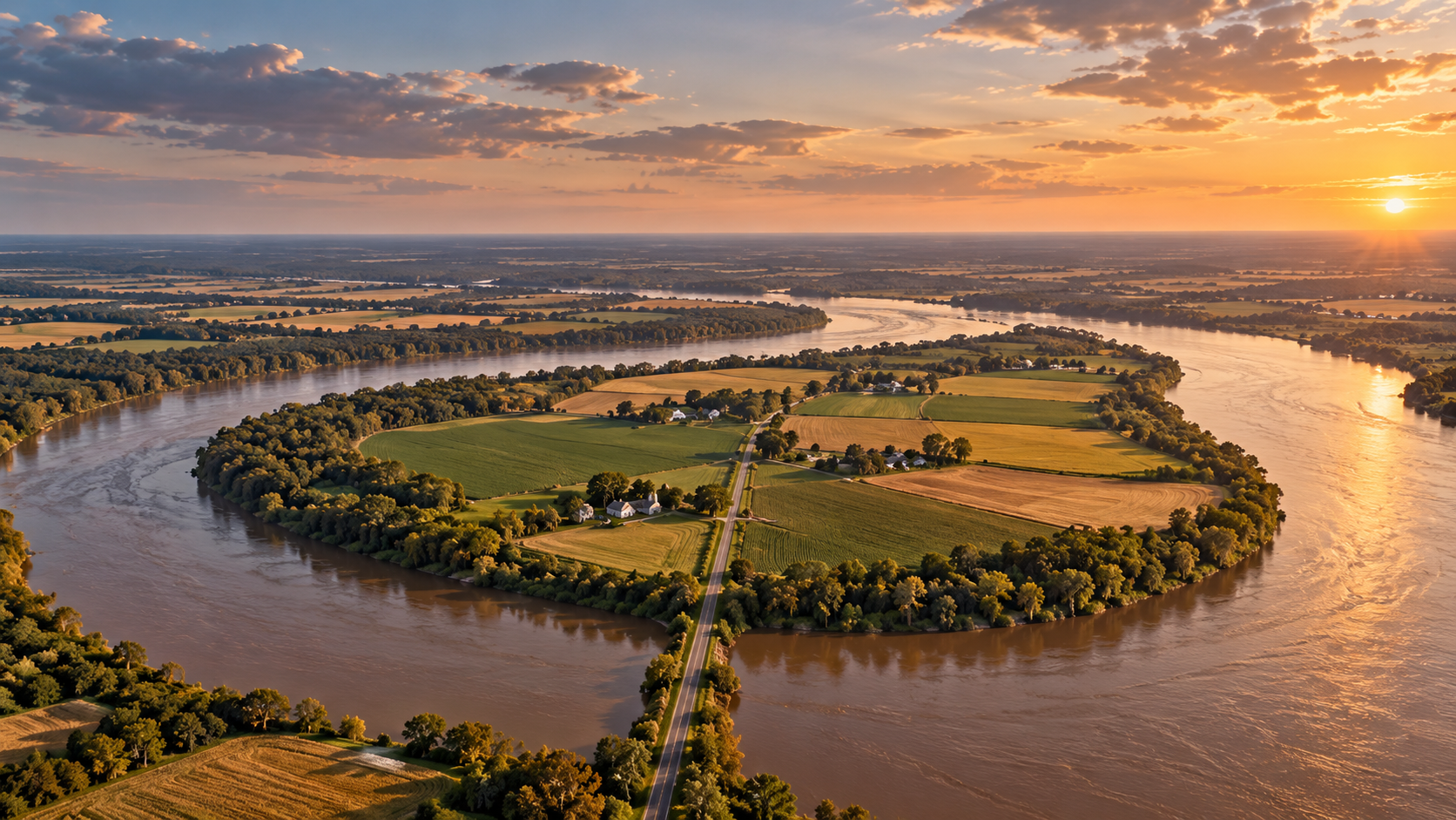
In the far southwestern corner of Kentucky, the Mississippi River makes a tight hairpin turn. Inside that loop is a teardrop of flat farmland that belongs to Kentucky, but doesn't touch the rest of Kentucky at all. The river wraps around it on three sides, with Missouri on the other bank, and the fourth side is the border with Tennessee. This is the Kentucky Bend. Locals have called it the New Madrid Bend, the Madrid Bend, the Bessie Bend, and even "Bubbleland." Officially it's an exclave of Fulton County, which is split into two separate pieces because of it. The Bend exists because of a line drawn before anyone knew exactly where it would land. The border between Kentucky and Tennessee was meant to follow a line of latitude west to the Mississippi. But surveyors had only estimated where that line would meet the river. When later, more detailed surveys traced it, the line turned out to cross the Mississippi's north-south bends, slicing off this loop of land and leaving it on the Kentucky side. Tennessee contested it, claiming the land for its own Obion County until at least 1848, but eventually dropped the claim. Some accounts say the great New Madrid earthquakes of 1811 and 1812 reshaped the river here and confused the surveyors, but that link is debated. The soil inside the loop turned out to be extremely rich. The Bend became cotton country, and the 1870 census counted more than 300 residents, most of them cotton farmers. Over the following century, the population shrank. The 2010 census counted about 18 people, and in 2020 the Kentucky Bend census division had just nine. Getting there means leaving Kentucky. From the main part of the state, you drive into Tennessee, then turn north on Tennessee State Route 22, the only highway into the Bend. Once you cross the state line, you're back in Kentucky, in a place no Kentucky road reaches. The Bend also holds the lowest point in the state, where the Mississippi flows past its banks at about 257 feet above sea level. The Kentucky Bend is still there, still Kentucky, and still reachable by road only through Tennessee.
Last corrected: Oct 6, 2026.
Grew up near here?
Get the free Kentucky guide: every Hidden Current place in the region, with what you can still see and how to get there.
State guides are coming soon. Email signup is not available yet.
Watch the short documentary
Kentucky Bend: The Kentucky Exclave You Reach Through Tennessee
Claim log
| # | Claim | Sources | Status |
|---|---|---|---|
| 1 | Kentucky Bend is at 36°32′N 89°31′W |
| Sourced |
| 2 | The Kentucky Bend, also called the New Madrid Bend, Madrid Bend, Bessie Bend, or Bubbleland, is an exclave of Fulton County, Kentucky encircled by the states of Tennessee and Missouri |
| Sourced |
| 3 | As of the 2020 census, the population of the Kentucky Bend Census County Division was nine people |
| Sourced |
| 4 | Kentucky Bend is the extreme southwestern corner of Kentucky |
| Sourced |
| 5 | The only highway into the area is Tennessee State Route 22, whose continuation into Kentucky Bend was once signed as Kentucky State Route 313 |
| Sourced |
| 6 | Surveyors had only estimated where their line would meet the Mississippi; later surveys revealed the line passed through north–south bends in the river, creating a division of the peninsula |
| Sourced |
| 7 | Tennessee contested the inclusion of the Kentucky Bend in Kentucky, claiming it as part of Obion County until at least 1848, but eventually dropped its claim |
| Sourced |
| 8 | The mailing address of the area is Tiptonville, Tennessee, with ZIP code 38079 |
| Sourced |
| 9 | Because of imprecise early surveying of Kentucky's southern border, Fulton County is divided into two non-contiguous parts; the exclave can be reached only by road through Tennessee |
| Sourced |
| 10 | Travelers have to pass into Tennessee by road, as there is no bridge from Missouri |
| Sourced |
| 11 | The lowest point in Kentucky is on the Mississippi River in Kentucky Bend |
| Sourced |
| 12 | The lowest elevation in Kentucky is 257 feet above sea level (Mississippi River) |
| Sourced |
| 13 | Kentucky's low point is 247 feet msl, depending on river pool level |
| Sourced |
| 14 | Tennessee borders the Bend to the south, and the river wraps the other three sides; drivers approach on Tennessee State Route 22 and retrace the same route out |
| Sourced |
| 15 | A Kentucky state sign marks the edge of the Kentucky Bend |
| Sourced |
| 16 | Kentucky Bend is 30 square miles of land formed by a combination of surveyor mishaps and earthquakes; as of the 2010 census, about 18 people lived there |
| Sourced |
| 17 | The population of the Bend swelled to 300 for almost a century as cotton farmers arrived |
| Sourced |
| 18 | The 1870 Census tallied more than 300 residents, mostly cotton-farmers |
| Sourced |
| 19 | Kentucky Bend is 17.5 square miles, bounded on three sides by a hairpin turn in the Mississippi and in the south by Tennessee |
| Sourced |
| 20 | Kentucky Bend is approximately 27 square miles |
| Sourced |
Disagreements logged
No approved disagreements are logged on this page yet.
Submit a disagreement
Disagree with a fact in this story? Submit a source-backed note for editorial review. It stays private until approved and does not automatically become a correction.
Sources
- Wikipedia
- Wikiwand
- U.S. Geological Survey National Atlas
- geocaching.com
- WorldAtlas
- Kentucky Department of Tourism
- Big Think
- grokipedia.com
Corrections
| # | Correction | Sources |
|---|---|---|
| 1 | Kentucky Bend is reached by road through only one other state, Tennessee, not two |
|
| 2 | There is no bridge from Missouri; the only highway into the Bend is Tennessee State Route 22 |
|
| 3 | The Bend's separation is documented as the result of imprecise early surveying, not solely the New Madrid earthquakes |
|
| 4 | Some sources say the Bend formed through a combination of surveyor mishaps and earthquakes |
|
| 5 | Some sources say the earthquakes created the river loop |
|
| 6 | The Bend is cut off by the Mississippi River on three sides and by Tennessee on the fourth, not by the river alone |
|
| 7 | Sources disagree on the Bend's size: 30 square miles |
|
| 8 | Sources disagree on the Bend's size: 17.5 square miles |
|
| 9 | Sources disagree on the Bend's size: approximately 27 square miles |
|
| 10 | Sources disagree on Kentucky's lowest elevation: 257 feet |
|
| 11 | Sources disagree on Kentucky's lowest elevation: 247 feet |
|
Hidden Current within 100 miles
More Isolated Places places
- The Island Almost Nobody Can Reach
- Supai, Arizona: The Village With No Road Where Mail Comes by Mule
- Kiruna, Sweden: The Arctic City Moving to Escape Its Own Mine
- Whittier, Alaska: The Town That Lives in One Building
- Bluie East Two: The WWII Air Base Abandoned in Greenland
- Point Roberts: The U.S. Town You Reach by Driving Through Canada