
Isolated Placesgeographygeographic anomalyWashington
Point Roberts: The U.S. Town You Reach by Driving Through Canada, Washington
Point Roberts, Washington sits below the 49th parallel on a Canadian peninsula. To drive to the rest of the U.S., residents cross the border twice.
Every claim sourced
28 claims · 28 sources
0 disagreements logged
6 editorial corrections
Last checked Oct 6, 2026
The story
The numbered claim log below connects facts in this story to their sources.
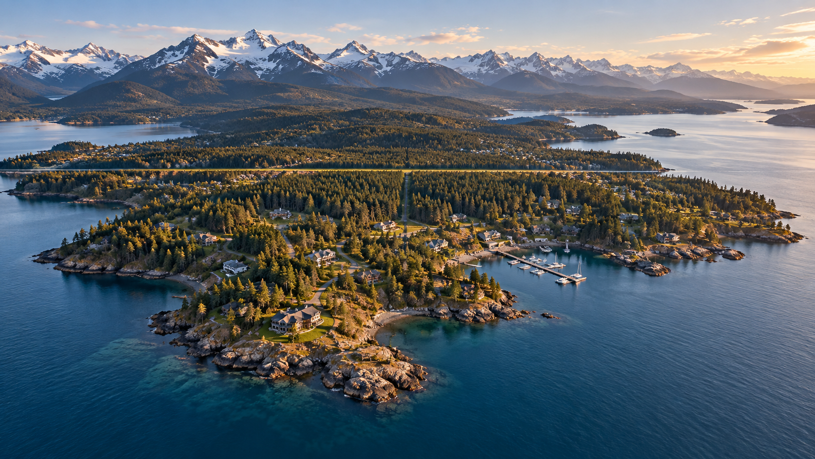
On a map, Point Roberts looks like a mistake. It's a small square of land, about five square miles, hanging off the bottom of a Canadian peninsula south of Vancouver. It belongs to the state of Washington, but it doesn't touch the rest of the United States anywhere on land. It traces back to a single straight line. In the 1840s, the U.S. and Britain were negotiating where to draw the border across the Pacific Northwest. On June 15, 1846, they signed the Oregon Treaty, agreeing that the boundary would follow the 49th parallel west to the coast. The southern tip of the Tsawwassen Peninsula happened to dip just below that line. Later, as the Boundary Commission surveyed the border, British officials realized that Point Roberts would be left as an isolated piece of the United States. The British raised it, but Point Roberts stayed American. Today the border cuts right across the top of the peninsula. Along Roosevelt Way, the town's northernmost street, some Canadian cul-de-sacs run up to the line from the other side, with just a curb separating the two countries. At the western end, Boundary Marker No. 1, a granite obelisk from the 1860s, marks where the land border between the two countries meets the sea. Life here runs through Canada. To drive to the nearest U.S. town, Point Roberts residents cross into Canada at a checkpoint at the north end of town, drive about 25 miles through British Columbia, then cross back into the U.S. near Blaine. The town has its own primary school, but older students cross the border twice a day by bus to attend school in Blaine. Point Roberts has always been closely tied to its Canadian neighbors. Icelandic settlers arrived in the late 1800s. In the 1950s, Canadians began building summer homes, and the summer population still swells far beyond the 1,191 year-round residents counted in the 2020 census, most of the visitors coming from Canada. Over the years, there have been proposals to change its status: talk of secession in 1949, and in 1952 a Canadian regional plan suggesting it become an international park or be leased to Canada. That dependence has a cost when the border tightens. During the COVID-19 pandemic, cross-border travel restrictions left the town isolated, and a temporary ferry was set up to Blaine. More recently, rising U.S.–Canada tensions led many Canadians to boycott U.S. destinations, Point Roberts included, cutting into the local businesses that rely on them.
Last corrected: Oct 6, 2026.
Grew up near here?
Get the free Washington guide: every Hidden Current place in the region, with what you can still see and how to get there.
State guides are coming soon. Email signup is not available yet.
Watch the short documentary
Point Roberts: The U.S. Town You Reach by Driving Through Canada, Washington
Claim log
| # | Claim | Sources | Status |
|---|---|---|---|
| 1 | Point Roberts is at 48°59′11″N 123°03′25″W |
| Sourced |
| 2 | Point Roberts is a pene-exclave of the US state of Washington on the southernmost tip of the Tsawwassen peninsula, south of Vancouver |
| Sourced |
| 3 | The area had a population of 1,191 at the 2020 census and is reached from the rest of the United States by traveling 25 mi (40 km) through Canada, or without passing through Canada by boat or private airplane |
| Sourced |
| 4 | The Oregon Treaty was concluded on June 15, 1846 |
| Sourced |
| 5 | The two parties agreed the 49th parallel would define the boundary, and Point Roberts is south of the 49th parallel |
| Sourced |
| 6 | As the Boundary Commission surveyed the line, the British government realized Point Roberts would be an isolated part of the United States |
| Sourced |
| 7 | In 1949, there was talk about Point Roberts seceding from the U.S. |
| Sourced |
| 8 | A 1952 regional development plan for the Lower Mainland suggested turning Point Roberts into an international park or leasing it for 99 or 999 years |
| Sourced |
| 9 | Point Roberts borders the municipality of Delta in British Columbia |
| Sourced |
| 10 | By land, Point Roberts can only be accessed via the Point Roberts–Boundary Bay crossing, the westernmost crossing in the contiguous United States |
| Sourced |
| 11 | The Point Roberts–Boundary Bay crossing operates 24 hours |
| Sourced |
| 12 | The US port is at 50 Tyee Drive, Point Roberts, WA 98281 |
| Sourced |
| 13 | Point Roberts is a five-square-mile American exclave |
| Sourced |
| 14 | Residents must cross into Canada at the northern end of town, drive about 25 miles, then cross back into the U.S. near Blaine, Washington |
| Sourced |
| 15 | Roosevelt Way runs parallel to the border, and Canadian cul-de-sacs in Tsawwassen run up to it with just a curb separating the two countries |
| Sourced |
| 16 | Older students cross the border twice daily via school bus to attend classes in Blaine, Washington |
| Sourced |
| 17 | There is no passenger ferry connecting Point Roberts to mainland Washington |
| Sourced |
| 18 | During the COVID-19 pandemic, a temporary ferry ran from Point Roberts to Blaine, ending in August 2021 |
| Sourced |
| 19 | During the summer, the population grows to about 4,500 people, mostly Canadians on vacation |
| Sourced |
| 20 | By 1904, 93 residents of Icelandic descent lived in Point Roberts |
| Sourced |
| 21 | Lighthouse Marine Park was dedicated in 1973, and Point Roberts Marina opened in 1977 |
| Sourced |
| 22 | Monument Park is at 49°0'5"N, 123°5'19"W and is home to Boundary Marker No. 1, marking the 49th parallel |
| Sourced |
| 23 | The Monument Park trail to the beach is currently closed due to a slide |
| Sourced |
| 24 | Boundary Marker No. 1 was erected in 1861 |
| Sourced |
| 25 | A county plaque says the obelisk was made in Scotland and placed in 1865 |
| Sourced |
| 26 | Boundary Marker No. 1 is an obelisk 19 feet in height |
| Sourced |
| 27 | Point Roberts Airpark is at 622 Marine Dr |
| Sourced |
| 28 | As anti-U.S. sentiment rose in Canada, many Canadian tourists boycotted U.S. destinations, including Point Roberts |
| Sourced |
Disagreements logged
No approved disagreements are logged on this page yet.
Submit a disagreement
Disagree with a fact in this story? Submit a source-backed note for editorial review. It stays private until approved and does not automatically become a correction.
Sources
- Wikipedia
- High Country News
- nomadlawyer.org
- Kiddle
- HistoryLink
- Whatcom County
- Historical Marker Database
- National Park Service
- Wikivoyage
- CP24
Corrections
| # | Correction | Sources |
|---|---|---|
| 1 | Residents do not have to travel through Canada to reach the rest of the U.S.; they can go by boat or private airplane, but by land the only route is through Canada |
|
| 2 | Point Roberts is a pene-exclave, connected to the U.S. by water, not a true exclave |
|
| 3 | Point Roberts had 1,191 residents at the 2020 census, not the "roughly 1,000" often cited |
|
| 4 | Sources disagree on when Boundary Marker No. 1 was placed: erected in 1861 according to Wikipedia |
|
| 5 | Sources disagree on when Boundary Marker No. 1 was placed: placed in 1865 according to a county plaque |
|
| 6 | There is no passenger ferry from mainland Washington; the temporary pandemic ferry ended in August 2021 |
|
More Isolated Places places
- The Island Almost Nobody Can Reach
- Supai, Arizona: The Village With No Road Where Mail Comes by Mule
- Kiruna, Sweden: The Arctic City Moving to Escape Its Own Mine
- Whittier, Alaska: The Town That Lives in One Building
- Bluie East Two: The WWII Air Base Abandoned in Greenland
- Kentucky Bend: The Kentucky Exclave You Reach Through Tennessee