
Forgotten AmericaBingham Canyon Minecopper miningUtah history
Bingham Canyon Mine: The Copper Pit That Swallowed Its Towns, Utah
As Utah's Bingham Canyon Mine grew into the largest human-made excavation on Earth, it swallowed the towns around it. Only Copperton is left standing.
Every claim sourced
28 claims · 28 sources
0 disagreements logged
9 editorial corrections
Last checked Oct 6, 2026
The story
The numbered claim log below connects facts in this story to their sources.
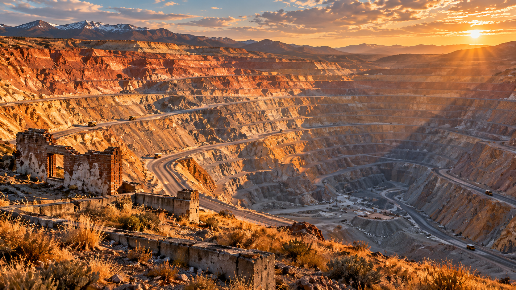
In the Oquirrh Mountains southwest of Salt Lake City, a narrow canyon once held a long, crowded mining town. Bingham Canyon was founded in 1863 and incorporated in 1904. At its peak, the city had about 15,000 residents. Its single main street ran up the bottom of the canyon, so narrow that a 1942 newspaper caption called it "the narrowest city in the world." Bingham wasn't one town but many. Up the side canyons were neighborhoods and camps such as Carr Fork, Highland Boy, Copperfield, Dinkeyville, Frog Town and Markham. Many had strong ethnic identities. Scandinavians lived in Carr Fork, and southern and eastern Europeans settled in Highland Boy. Down the hill, the separate town of Lark was established in 1866. What made the canyon rich was copper. In the 1890s, miners recognized a vast low-grade copper deposit. The Utah Copper Company was formed in 1903, and open-pit mining began in 1906. Instead of tunneling, the company dug the mountain away in great terraced steps. Over the decades, "the hill" became the world's largest open-pit copper mine. The problem was that the mine kept growing, and the towns were in the way. The company began relocating people as early as 1926, when it built Copperton as a company town on the flats at the canyon mouth. Through the middle of the 20th century, the expanding pit and its waste rock consumed the canyon. Copperfield was demolished in 1958, and Highland Boy and Copperfield were gone by 1960. By 1971, little of Bingham remained. Its last 31 residents voted to disincorporate, and the last buildings were razed in 1972. Lark came next. In 1977, Kennecott told Lark's 591 residents the town was coming down to make room for mine waste. The fight made national news. In 1978, Kennecott offered 120 percent of appraised value, $1,000 toward moving, and free relocation of homes to Copperton. By the end of 1980, Lark had disappeared from the map. The pit kept growing. Today it's about 2.5 miles across and nearly three-quarters of a mile deep, and it has produced more copper than any other mine in history. It was named a National Historic Landmark in 1966. In April 2013, a massive slide inside the pit sent tons of rock down its walls. Monitoring had warned of the movement in advance, and no one was hurt. Copperton, built to move people out of the canyon, celebrates its centennial in 2026. It's the only one of the canyon's towns still standing. The rest are now part of the pit or buried under its waste rock.
Last corrected: Oct 6, 2026.
Grew up near here?
Get the free Utah guide: every Hidden Current place in the region, with what you can still see and how to get there.
State guides are coming soon. Email signup is not available yet.
Watch the short documentary
Bingham Canyon Mine: The Copper Pit That Swallowed Its Towns, Utah
Claim log
| # | Claim | Sources | Status |
|---|---|---|---|
| 1 | Bingham Canyon Mine is at 40°31′23″N 112°09′04″W in Salt Lake County |
| Sourced |
| 2 | Bingham Canyon Mine is the largest human-made excavation and deepest open-pit mine in the world, producing more than 19,000,000 short tons of copper |
| Sourced |
| 3 | Bingham Canyon Mine was added to the NRHP and designated a National Historic Landmark on November 13, 1966 |
| Sourced |
| 4 | The mine opened in 1906 and is owned by Rio Tinto Group |
| Sourced |
| 5 | Bingham Canyon was formerly located at 40°33′30″N 112°07′50″W, with GNIS feature ID 1425580 |
| Sourced |
| 6 | Bingham Canyon was founded in 1863, incorporated February 29, 1904, and abandoned in 1972 |
| Sourced |
| 7 | At its peak Bingham Canyon had approximately 15,000 residents; by the 1970s almost the entire town had been devoured by the mine |
| Sourced |
| 8 | Bingham Canyon's 31 remaining residents voted 11–2 to disincorporate |
| Sourced |
| 9 | Many Scandinavians lived in Carr Fork, while southern and eastern Europeans congregated in Highland Boy |
| Sourced |
| 10 | Utah Copper established Copperton on the flats east of the canyon mouth in 1926 |
| Sourced |
| 11 | By 1971 little of Bingham remained, and the last buildings were razed in 1972 |
| Sourced |
| 12 | A 1942 newspaper caption called Bingham's single street the narrowest city in the world |
| Sourced |
| 13 | In 1958, Kennecott demolished Copperfield to deepen the pit |
| Sourced |
| 14 | Smaller camps included Frog Town, Freeman, Heaston Heights, Markham, Copper Heights, Dinkeyville, and Terrace Heights |
| Sourced |
| 15 | Highland Boy and Copperfield were dismantled by 1960, the last buildings in Bingham were torn down in 1972, and Lark disappeared from the map by the end of 1980 |
| Sourced |
| 16 | Copperton remains the sole survivor of the communities of Bingham Canyon |
| Sourced |
| 17 | Copperton was established by the Utah Copper Company in 1926 and is the only mining town remaining after Lark was torn down in 1980 |
| Sourced |
| 18 | 2026 is the centennial year for Copperton, the last surviving town of Bingham Canyon |
| Sourced |
| 19 | Lark was officially established January 3, 1866; its population was 591; by 1978 Lark was dismantled |
| Sourced |
| 20 | On Dec. 14, 1977, a Kennecott official summoned Lark's 591 residents to a meeting |
| Sourced |
| 21 | In May 1978, Kennecott offered 120 percent of appraised home values, $1,000 toward relocation, and free moving of homes to Copperton |
| Sourced |
| 22 | The Utah Copper Company formed in 1903, and large-scale open-pit operations began in 1906 |
| Sourced |
| 23 | Kennecott's Bingham Canyon Mine was founded in 1903 and operates 24 hours a day, 365 days a year |
| Sourced |
| 24 | The Visitor Experience is self-guided at the mine overlook, with a view of the active pit and 2 levels of exhibits; tickets should be purchased in advance online |
| Sourced |
| 25 | Visitor Experience tickets are $6, children under 5 are free, and sales are donated to the Kennecott Charitable Foundation; guests take shuttles to the overlook |
| Sourced |
| 26 | The mine measures roughly 0.75 miles deep and 2.5 miles across, covering approximately 1,900 acres; the Visitor Experience is typically open April through October |
| Sourced |
| 27 | The mine measures 2.75 miles across and three-quarters of a mile deep |
| Sourced |
| 28 | Mining operations were shut down the day before the 2013 slide because of warnings from monitoring, and there were no injuries |
| Sourced |
Disagreements logged
No approved disagreements are logged on this page yet.
Submit a disagreement
Disagree with a fact in this story? Submit a source-backed note for editorial review. It stays private until approved and does not automatically become a correction.
Sources
- Wikipedia
- The Salt Lake Tribune
- Utah History Encyclopedia
- copperton.utah.gov
- South Jordan Journal
- Salt Lake City Weekly
- grokipedia.com
- Rio Tinto
- Fox 13
- TripAdvisor
- KSL
Corrections
| # | Correction | Sources |
|---|---|---|
| 1 | Not every community disappeared; Copperton, established in 1926, remains the sole survivor of the Bingham Canyon towns |
|
| 2 | Copperton was built in 1926, not in the 1950s as stated on one historical marker summary |
|
| 3 | One historical marker summary states Copperton was built as a company town in the 1950s |
|
| 4 | Sources disagree on when the mine began: Rio Tinto says it was founded in 1903, while Wikipedia says it opened in 1906 |
|
| 5 | Sources disagree on when the mine began: Rio Tinto says it was founded in 1903, while Wikipedia says it opened in 1906 |
|
| 6 | Sources disagree on the mine's width: about 2.5 miles across |
|
| 7 | Sources disagree on the mine's width: 2.75 miles across |
|
| 8 | Sources disagree on when Lark disappeared: dismantled by 1978 |
|
| 9 | Sources disagree on when Lark disappeared: off the map by the end of 1980 |
|