Forgotten Americaburning undergroundPennsylvaniatown
Town Burning Underground, Pennsylvania
A town in Pennsylvania that has been burning underground since 1962.
Every claim sourced
35 claims · 35 sources
0 disagreements logged
3 editorial corrections
Last checked Oct 2, 2026
The story
The numbered claim log below connects facts in this story to their sources.
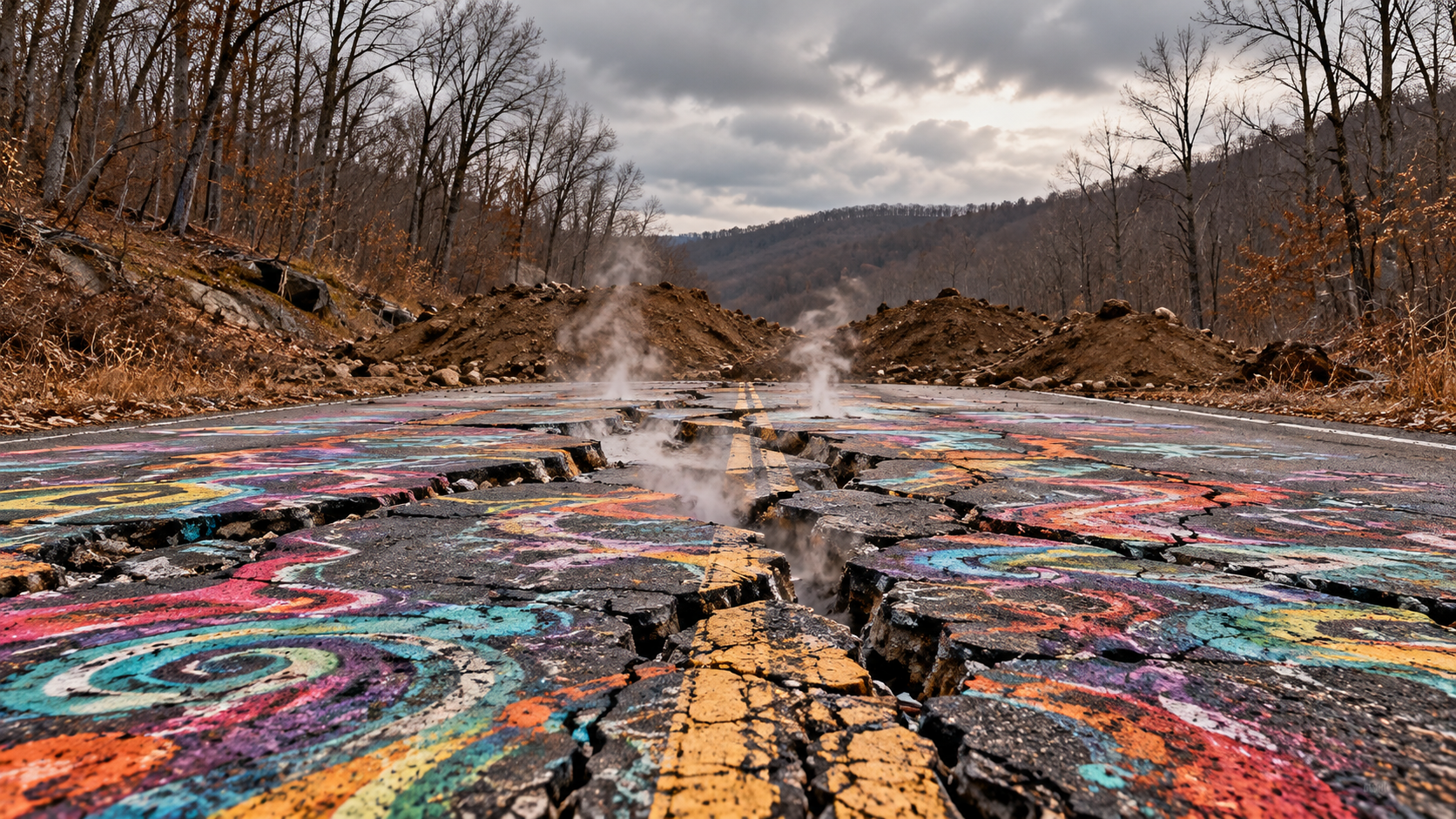
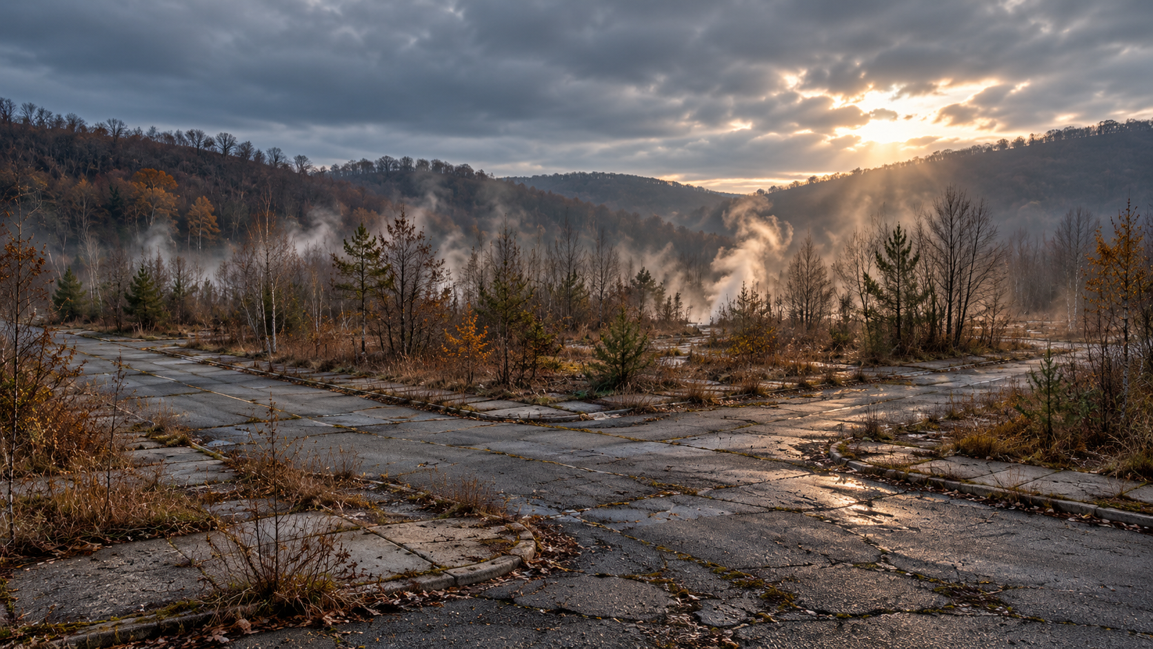
Centralia sits on a ridge in Pennsylvania's anthracite coal region, a few miles north of Ashland. The railroad arrived in 1865, the town incorporated as a borough in 1866, and for decades it was an ordinary working coal town. At its peak in 1890, it counted 2,761 residents. The event that emptied it began in late May 1962. The borough's landfill was an abandoned strip-mine pit, and before Memorial Day firefighters set the trash in it alight to clean it up. The fire did not stay in the pit. It found a path into the network of abandoned mine tunnels beneath the town and reached the coal seams below. The landfill burn is the most widely accepted account of how the fire started, though some residents and researchers have argued for other origins. Over the next two decades, state and federal crews tried repeatedly to dig out, flush, or starve the fire. None of it worked. Excavation sometimes made things worse by letting fresh air into the underground chambers. Residents reported gas seeping into their basements and smoke rising from the ground. The turning point came on Valentine's Day 1981. Twelve-year-old Todd Domboski was in his grandmother's backyard when the ground gave way beneath him. He held onto an exposed tree root over a steaming hole until his cousin pulled him out. The incident drew national attention to a problem that had been building for nearly twenty years. In 1983, Congress appropriated more than $42 million for a voluntary relocation program, and that August most residents voted to accept it. Families took buyouts and moved, many to nearby Mount Carmel and Ashland. Houses were condemned, boarded up, and demolished block by block. By the end of the decade, more than 1,000 people had left and about 500 structures were gone. The neighboring village of Byrnesville, which sat above part of the same fire, was abandoned too. Some residents refused to leave. In 1992, Governor Bob Casey invoked eminent domain over every property in the borough, and a legal challenge by the remaining residents failed. The U.S. Postal Service discontinued Centralia's ZIP code, 17927, in 2002, and the area is now served through Ashland. In 2009, Governor Ed Rendell's administration began formal eviction proceedings against the holdouts. The standoff ended in October 2013. Eight remaining residents settled their federal lawsuit with the state. The agreement lets them stay in their homes for the rest of their lives and paid them $349,500, after which the properties pass to the Commonwealth. Some holdouts long argued that the relocation was really about the coal beneath the town. That claim has never been substantiated, but it remains part of local memory. Part of Pennsylvania Route 61 through town buckled and cracked above the fire and was bypassed. That abandoned stretch became known as the "Graffiti Highway" and drew visitors for years. In April 2020, the private landowner, Pagnotti Enterprises, buried it under dirt to stop trespassing. It no longer exists. Today, Centralia is a street grid with almost nothing on it. Sidewalks run past empty lots, the borough's cemeteries are still maintained, and on the hill at the north edge of town stands the Assumption of the Blessed Virgin Mary Ukrainian Catholic Church, built in 1911, which still holds services and hosts an annual pilgrimage. Five people were living in the borough at the 2020 Census, making Centralia the least-populated municipality in Pennsylvania. The fire beneath it is still burning. Visiting The public streets are open to walk or drive at any time. Private homes and posted areas are off-limits, and so is the site of the former Graffiti Highway. Pennsylvania officials discourage visits because of ground subsidence and gases near fire zones, so stay on roads and paths and out of fenced or smoking ground. The church's address is North Paxton Street; contact the parish office at 570-648-5932 for service times. The nearest services are in Ashland and Mount Carmel.
Last corrected: Oct 3, 2026.
Grew up near here?
Get the free Pennsylvania guide: every Hidden Current place in the region, with what you can still see and how to get there.
State guides are coming soon. Email signup is not available yet.
Watch the short documentary
Town Burning Underground, Pennsylvania
Claim log
| # | Claim | Sources | Status |
|---|---|---|---|
| 1 | Centralia is at 40.8042541 N, -76.3405035 W, about 1,463 ft elevation |
| Sourced |
| 2 | Centralia was incorporated as a borough in 1866 |
| Sourced |
| 3 | Centralia was incorporated in February 1866, after earlier life as Bull's Head and then Centreville |
| Sourced |
| 4 | Centralia reached its maximum population of 2,761 in 1890, according to federal census records |
| Sourced |
| 5 | Centralia's population peaked at roughly 2,761 residents around 1890 |
| Sourced |
| 6 | On May 27, 1962, local firefighters set the town landfill on fire to clean it up before Memorial Day |
| Sourced |
| 7 | The most widely accepted consensus is that the fire began on May 27, 1962, when a fire was ignited at a landfill over an old mine entrance |
| Sourced |
| 8 | There is no official explanation of what caused the Centralia fire |
| Sourced |
| 9 | Accounts of how the fire started differ |
| Sourced |
| 10 | The fire started in May 1962 in the Buck Mountain Coal Bed |
| Sourced |
| 11 | Between 1962 and 1978, state and federal authorities spent millions of dollars trying to put out the fire without success |
| Sourced |
| 12 | On Valentine's Day 1981, 12-year-old Todd Domboski was in his grandmother's backyard when the ground opened; he clung to exposed tree roots until his cousin pulled him to safety |
| Sourced |
| 13 | On Valentine's Day 1981, Todd Domboski was in his grandmother's backyard when the earth gave way beneath him |
| Sourced |
| 14 | In December 1983, Congress appropriated $42 million to relocate residents affected by the fire |
| Sourced |
| 15 | In late 1983, Congress approved $42 million to help move families, with relocation offers extended to residents of Byrnesville and Centralia |
| Sourced |
| 16 | In 1985, Byrnesville had approximately 75 people living in 29 homes |
| Sourced |
| 17 | In 1984 a voluntary relocation program began; many residents accepted buyouts and their homes were leveled |
| Sourced |
| 18 | By the end of the 1980s, more than 1,000 people had moved and 500 structures had been demolished under a $42 million federal relocation program |
| Sourced |
| 19 | In 1992, Pennsylvania claimed eminent domain over all real estate in the borough and condemned it |
| Sourced |
| 20 | In 1992, Governor Bob Casey invoked eminent domain over every property in the borough |
| Sourced |
| 21 | On July 13, 1992, Governor Bob Casey invoked eminent domain on every remaining property in Centralia |
| Sourced |
| 22 | Centralia's ZIP Code 17927 was discontinued in 2002; the area is served by Ashland's 17921 |
| Sourced |
| 23 | Centralia's ZIP Code 17927 was discontinued in 2002; the area is served by Ashland's 17921 |
| Sourced |
| 24 | In October 2013, eight residents settled their lawsuit, allowing them to stay in their homes for as long as they live, with a cash payout of $349,500 |
| Sourced |
| 25 | The settlement included $218,000 for the value of homes and $131,500 for other claims, according to the state Department of Community and Economic Development |
| Sourced |
| 26 | On October 29, 2013, officials reached an agreement with the then seven remaining residents allowing them to remain until their deaths |
| Sourced |
| 27 | Centralia's population declined from 1,000 in 1980 to five residents in 2020 |
| Sourced |
| 28 | Centralia had five residents in the 2020 census, the fewest of any municipality in Pennsylvania |
| Sourced |
| 29 | Pagnotti Enterprises acquired the Graffiti Highway land in February 2018 and buried the highway in early April 2020 |
| Sourced |
| 30 | About 400 dump truck loads of dirt covered the one-mile stretch of the Graffiti Highway |
| Sourced |
| 31 | The Assumption of the Blessed Virgin Mary Ukrainian Catholic Church was built in 1911 and remained open |
| Sourced |
| 32 | The church has become an unofficial pilgrimage site for Ukrainian Catholics |
| Sourced |
| 33 | The church is on North Paxton Street, Centralia, PA 17927, with the parish office at 570-648-5932 |
| Sourced |
| 34 | The church was one of seven churches that once served the town |
| Sourced |
| 35 | Much of the land around Centralia is private property owned by companies or the state |
| Sourced |
Disagreements logged
No approved disagreements are logged on this page yet.
Submit a disagreement
Disagree with a fact in this story? Submit a source-backed note for editorial review. It stays private until approved and does not automatically become a correction.
Sources
- TopoZone
- Wikipedia
- experiencepa.com
- centraliapa.org
- Discovery UK
- WorldAtlas
- Yahoo News
- Associated Press
- travelandtannins.com
- Atlas Obscura
Corrections
| # | Correction | Sources |
|---|---|---|
| 1 | Centralia is not empty: five residents remained as of the 2020 census |
|
| 2 | The Graffiti Highway no longer exists: Pagnotti Enterprises buried it in early April 2020 |
|
| 3 | There is no official explanation of what caused the fire; the May 27, 1962 landfill fire is the most widely accepted account |
|