Forgotten AmericaGilmanColoradoEagle Mine
Gilman: Colorado’s Cliffside Toxic Ghost Town
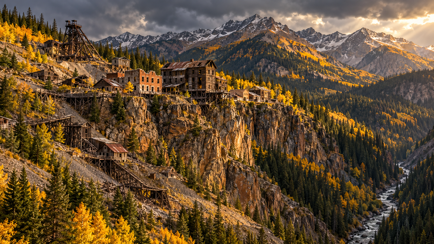
Gilman, Colorado clings to a cliff 600 feet above the Eagle River. Its zinc and lead mine closed in 1984, and the town has stood empty ever since.
Every claim sourced
21 claims · 21 sources
0 disagreements logged
4 editorial corrections
Last checked Oct 8, 2026
The story
The numbered claim log below connects facts in this story to their sources.
High on Battle Mountain, nearly 9,000 feet up, a cluster of buildings sits right at the edge of a cliff about 600 feet above the Eagle River. That’s Gilman. The town began in 1886, during the Colorado Silver Boom. In 1912, the New Jersey Zinc Company bought the main mines and the town itself, and Gilman became a company town built around the Eagle Mine. Workers dug zinc, lead and copper out of the mountain, along with silver and gold. By 1970, the mines had produced 858,000 tons of zinc and 148,000 tons of lead. The mining left behind about 8 million tons of waste and soil laced with arsenic, cadmium, copper, lead and zinc. Runoff caused large fish kills in the Eagle River and threatened drinking water downstream in Minturn. In 1984, the mine closed and the town was abandoned. Wikipedia says that was by order of the EPA, and Vail Magazine says the EPA ordered out the remaining residents after most had already left. In 1986, a 235-acre area was placed on the federal Superfund list. Cleanup began in 1988: crews plugged and flooded the mine, capped the waste and built a treatment plant that still filters heavy metals out of the water. Plans to turn Gilman into a private ski resort came and went in the 2000s. Today its schools, homes and offices stand empty and covered in graffiti, and the road in is chained shut. You can only see it from the highway.
Last corrected: Oct 8, 2026.
Grew up near here?
Get the free Colorado guide: every Hidden Current place in the region, with what you can still see and how to get there.
State guides are coming soon. Email signup is not available yet.
Watch the short documentary
Gilman: Colorado’s Cliffside Toxic Ghost Town
Claim log
| # | Claim | Sources | Status |
|---|---|---|---|
| 1 | Gilman coordinates are 39°31′58″N 106°23′38″W. |
| Sourced |
| 2 | Gilman sits on a cliff about 600 ft above the Eagle River on the flank of Battle Mountain. |
| Sourced |
| 3 | Gilman's elevation is 8,951 ft. |
| Sourced |
| 4 | Gilman was founded in 1886 during the Colorado Silver Boom. |
| Sourced |
| 5 | The New Jersey Zinc Company bought the principal mines and the townsite in 1912. |
| Sourced |
| 6 | The ore minerals were sphalerite (zinc), chalcopyrite (copper), and galena (lead), with silver and gold also produced. |
| Sourced |
| 7 | By 1970 the mines had produced 858,000 tons of zinc and 148,000 tons of lead. |
| Sourced |
| 8 | The town was abandoned in 1984 by order of the EPA because of toxic pollutants and unprofitable mines. |
| Sourced |
| 9 | The Eagle Mine closed in 1984. |
| Sourced |
| 10 | After the mine was abandoned, the EPA ordered the remaining residents out. |
| Sourced |
| 11 | Most residents had already left before the EPA order. |
| Sourced |
| 12 | A 235-acre area was placed on the National Priorities List in 1986. |
| Sourced |
| 13 | The site included 8 million tons of mine waste. |
| Sourced |
| 14 | Mining left arsenic, cadmium, copper, lead, and zinc in the soil. |
| Sourced |
| 15 | Contaminants caused large fish die-offs in the Eagle River and threatened drinking water in Minturn. |
| Sourced |
| 16 | Cleanup began in 1988 with plugging and flooding the mine, treating water, and capping waste. |
| Sourced |
| 17 | A water treatment plant filters heavy metals still seeping from the mine. |
| Sourced |
| 18 | The Ginn Company planned a ski resort in 2007. |
| Sourced |
| 19 | The town is private property and strictly off limits to the public. |
| Sourced |
| 20 | Entering the site is criminal trespassing and strictly enforced. |
| Sourced |
| 21 | A pullout on Highway 24, 2.3 miles from Tigiwon Road, is the suggested viewing spot. |
| Sourced |
Disagreements logged
No approved disagreements are logged on this page yet.
Submit a disagreement
Disagree with a fact in this story? Submit a source-backed note for editorial review. It stays private until approved and does not automatically become a correction.
Sources
- Wikipedia
- vailmag.com
Corrections
| # | Correction | Sources |
|---|---|---|
| 1 | The order is reversed: the town was abandoned in 1984, and the Superfund listing came in 1986. |
|
| 2 | Sources differ on the evacuation: one says the town was abandoned by EPA order, another says the EPA ordered out remaining residents after most had already left. |
|
| 3 | Sources differ on the evacuation: one says the town was abandoned by EPA order, another says the EPA ordered out remaining residents after most had already left. |
|
| 4 | The mine also produced copper, silver, and gold, not only zinc and lead. |
|