
Hidden LandscapesThe WaveArizonaNavajo Sandstone
The Wave: Arizona’s Lottery-Only Sandstone
The Wave is a ribbed swirl of Jurassic Navajo Sandstone near the Arizona-Utah border. Only 64 hikers a day get permits, all drawn through BLM lotteries.
Every claim sourced
19 claims · 19 sources
0 disagreements logged
3 editorial corrections
Last checked Oct 8, 2026
The story
The numbered claim log below connects facts in this story to their sources.
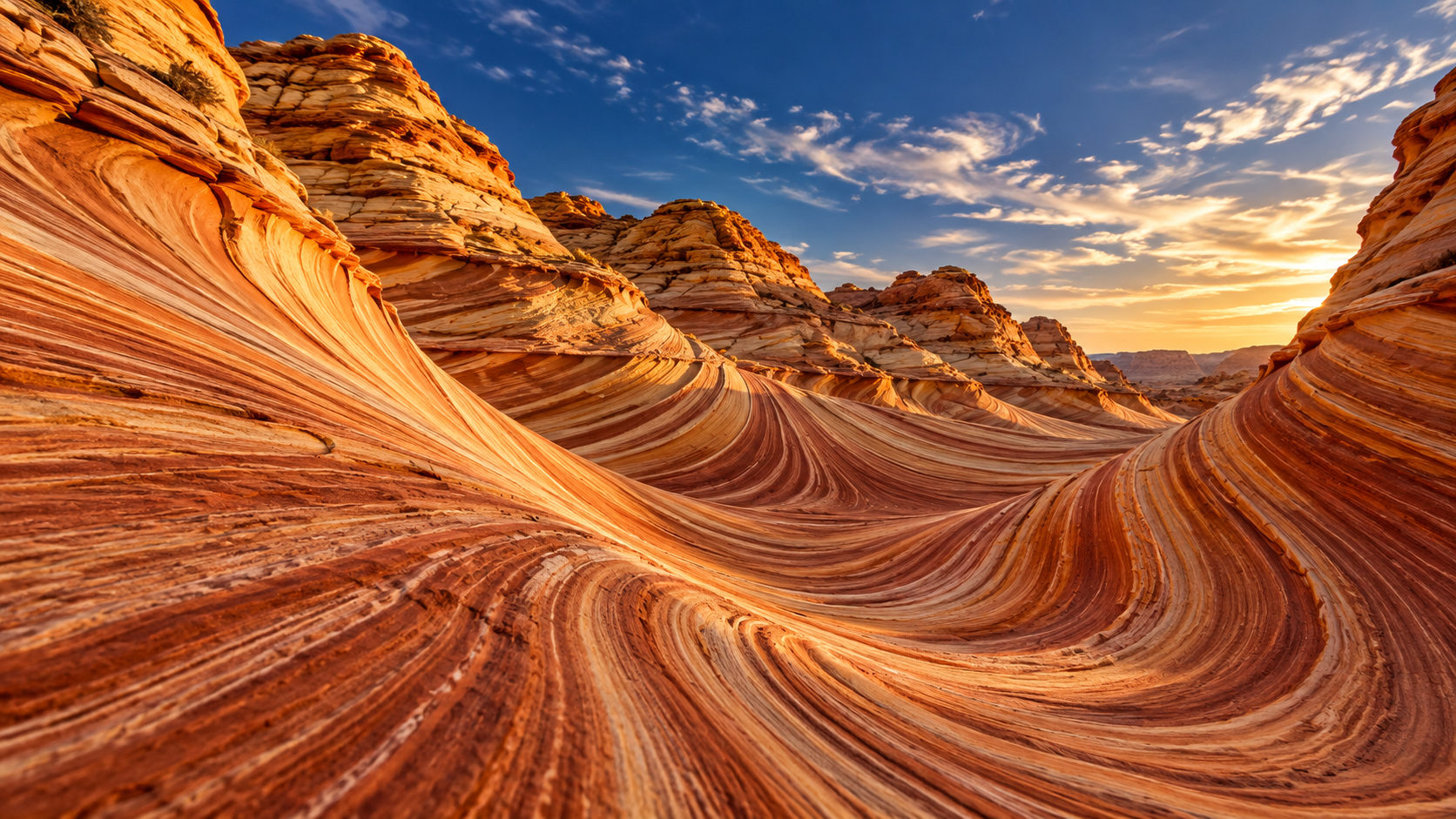
On the slopes of Coyote Buttes, just south of the Utah border, a hollow of sandstone curves and ripples in bands of red, orange, cream and gold. Hikers call it the Wave. The rock is Navajo Sandstone, formed from huge sand dunes that drifted across the region during the Jurassic period. As layer after layer of sand piled up, the dunes left sloping lines that show today as the Wave’s stripes. Runoff first cut troughs along cracks in the stone. Over time the drainage shrank, and the wind took over, scouring the softer layers faster than the harder ones. That’s what produces the fine ribs and fins that make the Wave look like it’s moving. For years almost no one knew it existed. Then it appeared in German nature documentaries in the 1990s and 2000s, and European travelers began seeking it out. As more people came, the ridges, some only fractions of an inch thick, began to wear away. To protect it, the Bureau of Land Management limits visitors to 64 a day, chosen by lottery. Most spots go through an advance lottery held four months out. The rest go through a daily lottery that you can only enter if you’re physically near the area. Each year, far more people apply than win. Those who do get a permit face a hike of about three miles each way across open desert with no marked trail.
Last corrected: Oct 8, 2026.
Grew up near here?
Get the free Arizona guide: every Hidden Current place in the region, with what you can still see and how to get there.
State guides are coming soon. Email signup is not available yet.
Watch the short documentary
The Wave: Arizona’s Lottery-Only Sandstone
Claim log
| # | Claim | Sources | Status |
|---|---|---|---|
| 1 | The Wave coordinates are 36°59′46″N 112°00′22″W. |
| Sourced |
| 2 | The Wave is in Coconino County, Arizona, on the slopes of Coyote Buttes near the Utah border. |
| Sourced |
| 3 | The Wave is within the Paria Canyon-Vermilion Cliffs Wilderness. |
| Sourced |
| 4 | The Wave is Navajo Sandstone of Jurassic age. |
| Sourced |
| 5 | The sandstone is cross-bedded eolian deposits from migrating dunes. |
| Sourced |
| 6 | Runoff first cut troughs along joints, and wind now does most of the erosion. |
| Sourced |
| 7 | The ridges and ribbing come from differential erosion of layers with different cementation. |
| Sourced |
| 8 | The soft sandstone is fragile, especially the ridges and ribbing. |
| Sourced |
| 9 | The Wave appeared in the German documentary Fascinating Nature (1996). |
| Sourced |
| 10 | The Wave is especially well known among European tourists. |
| Sourced |
| 11 | 64 permits are available per day. |
| Sourced |
| 12 | 48 permits are available through an advance online lottery and 16 through a daily geofenced lottery. |
| Sourced |
| 13 | The advance lottery is held four months before the month of the planned hike. |
| Sourced |
| 14 | The daily lottery is held two days before the hike within a geofence covering Kanab, Vermilion Cliffs, and Page areas. |
| Sourced |
| 15 | Access is limited to preserve wilderness character and limit damage to the fragile area. |
| Sourced |
| 16 | Permits are non-refundable and non-transferable. |
| Sourced |
| 17 | The suggested route is a strenuous 6.4-mile round trip. |
| Sourced |
| 18 | The hike is about 3 miles each way from the Wire Pass Trailhead with no marked trails. |
| Sourced |
| 19 | Summer temperatures often exceed 100 °F. |
| Sourced |
Disagreements logged
No approved disagreements are logged on this page yet.
Submit a disagreement
Disagree with a fact in this story? Submit a source-backed note for editorial review. It stays private until approved and does not automatically become a correction.
Sources
- Wikipedia
- blm.gov
Corrections
| # | Correction | Sources |
|---|---|---|
| 1 | The lottery limits visitors to 64 per day, split between an advance online lottery and a daily geofenced lottery. |
|
| 2 | The limits are intended to preserve wilderness character as well as limit damage to the fragile area. |
|
| 3 | The Wave was shaped first by runoff and now mainly by wind erosion. |
|
Hidden Current within 100 miles
More Hidden Landscapes places
- The Desert Hidden Between These Mountains
- Lake Nyos: The Lake That Released a Deadly Cloud in One Night
- Ruby Falls: The Waterfall Hidden Inside Lookout Mountain
- Thor's Well ("the drainpipe of the Pacific")
- Lost Lake, Oregon: The Lake That Drains Into a Hole Every Summer
- Lost River, Indiana: The River That Disappears Underground